The area around a municipal well is identified as a source protection vulnerable area. Vulnerable areas supply water to our municipal wells. Everyone must use extra care when undertaking activities in these areas because it could directly impact the quality and long-term availability of our drinking water.
Is my property in a vulnerable area?
Use our interactive map to find out if your property is in one of the vulnerable areas.
What steps should I take?
If your property is in a vulnerable area and you are conducting an activity identified as a drinking water threat, you may be required to develop a Risk Management Plan.
If you are submitting a planning or building permit application for a property in a vulnerable area, you must get additional approvals before proceeding with your application submission. Review our source protection applications and guidelines for more information.
Wellhead protection areas
There are two key types of vulnerable areas in Orangeville:
Wellhead protection areas for quality |
|
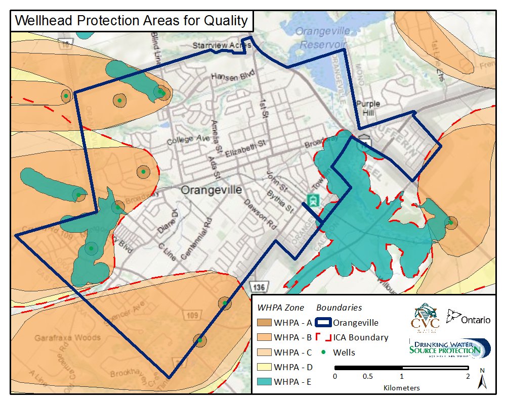
A wellhead protection area (WHPA) for quality is the area around the well where land use activities have the potential to affect the quality of water that flows into the well. View our wellhead protection quality map to identify some of the vulnerable areas:
An Issue Contributing Area (ICA) represents an area that supplies water to a well with an identified issue. A well has an issue when it shows an increasing trend of a contaminant. Orangeville has three sodium and chloride issue contributing areas due to increasing concentrations of sodium and chloride at several wells. Although the water is safe to drink, management measures are being put in place to reverse the rising trend. |
Wellhead protection areas for quantity |
|
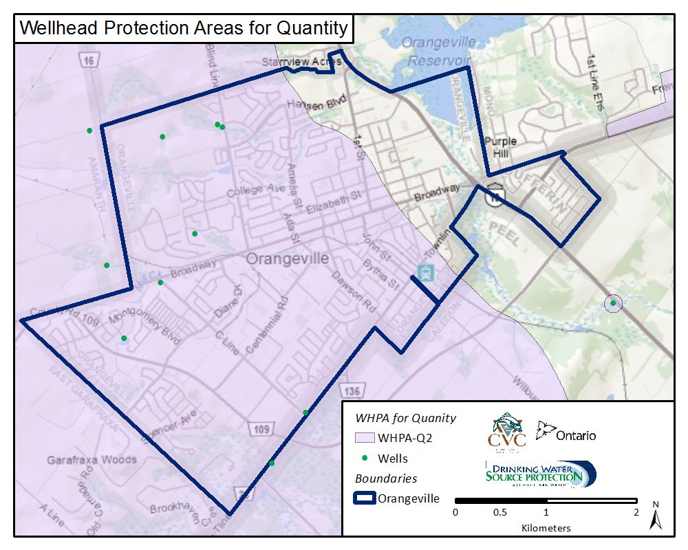
A wellhead protection area for quantity groundwater use and reductions in groundwater recharge rates could affect the quantity of water available in municipal wells. The WHPA- Q1/Q2 is delineated to protect the quantity of water required by the Town to meet both current and future water supply needs.
View our wellhead protection area for quantity map to identify these areas. |


 (WHPA-Q1/Q2) represents the area where